Artificial intelligence to design a balanced
and efficient living environment
and efficient living environment
Set of AI-solutions used at all stages of urban design: initial data gathering, stakeholder engagement, quality assurance, static, and simulation analysis of territory, city structure optimization, preparation of deliverables.
All these components make it possible to reduce the cost of design projects and the amount of human labor as well as improve the quality of outcome documents.
All these components make it possible to reduce the cost of design projects and the amount of human labor as well as improve the quality of outcome documents.

Initial data extraction collection by means of computer vision

“Data Lake” technology ensures efficient conversion of raw data into a digital model in machine-readable format for further automation and data processing

Computational analysis of the data for completeness and compliance with design standards to ensure data quality and completeness.
Geoportal for stakeholder engagement. Publication of progress of the project execution on all stages of project, gathering feedback and updates from citizens and stakeholders.

Analytical tools that provide static and simulation analysis of the current state and proposed decisions, indicating conflicts and contradictions. Examples of contradiction that can be instantly detected by automated solution:
We use simulation analysis as a tool for assessment of the road network efficiency over existing or future land use structure. And vice versa - it makes it possible to estimate the impact of proposed urban change on the traffic situation on the scale of the entire city.
- residential building in an industrial facility protection zone
- modern style development in historic districts
- deficiency of healthcare facilities, etc.
We use simulation analysis as a tool for assessment of the road network efficiency over existing or future land use structure. And vice versa - it makes it possible to estimate the impact of proposed urban change on the traffic situation on the scale of the entire city.

AI-optimization of the territory structure. Searching for optimal locations of required objects of importance (parks, schools, kindergartens) in case of deficiency

Automated generation of any type of outcomes, including drawings and documents
Why do we need it?
Digital transformation has come to the urban planning field and affected all the aspects of urban designing. Our solution offer the following features that bring urban planning process to the next level:
Showcase
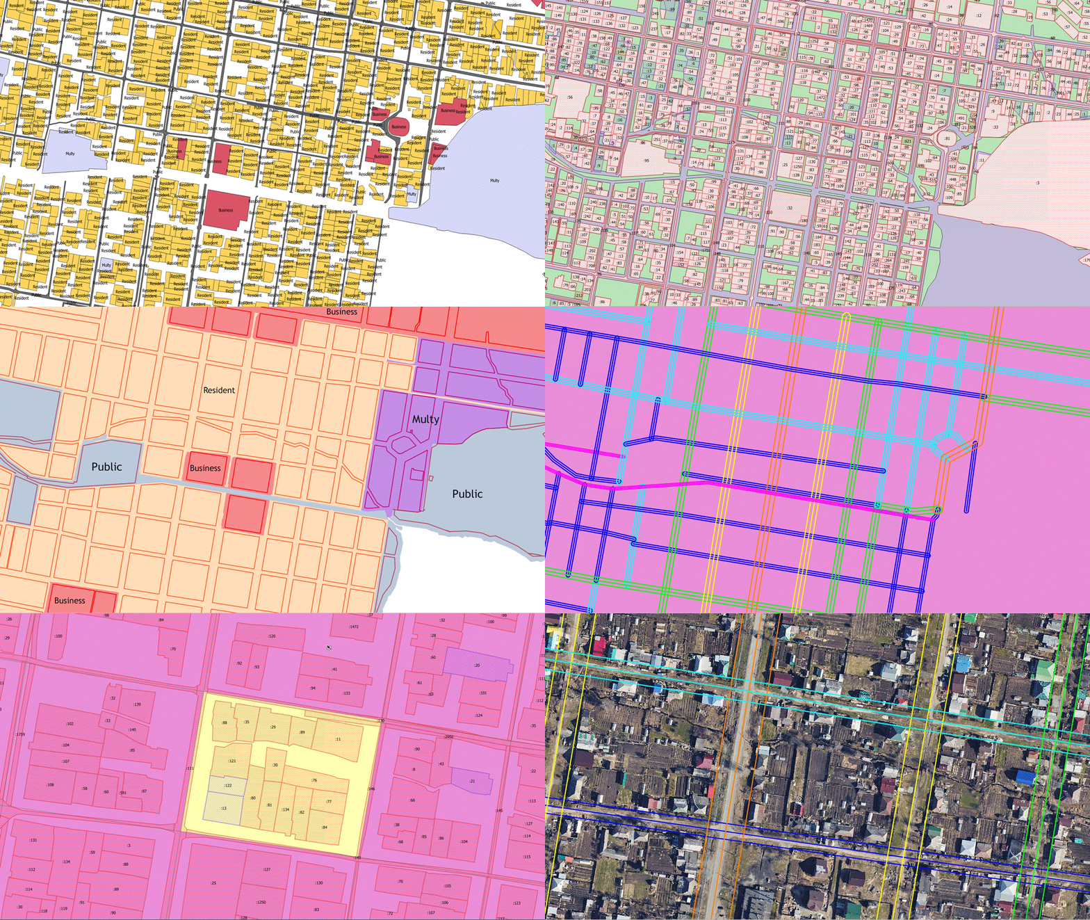
Here you can see some screenshot from our tailor-made soft


- the business logic;
- setting up execution stages;
- configuring the events that complete the stages;
- setting up the results of events that initiate a stage;
- setting up output document templates;
- setting up documents related to the execution process;
- setting up the nested execution processes;
- setting up process concurrency;
- configuring normative timelines for process execution and each step within the execution process.
The Customer has the right to demand to finalize the execution processes and bring them to an acceptable form for the Customer. The list of revisions is agreed with the Customer and submitted to the Contractor for revision.
Land management
Land Management was created to automate the management of land resources and effectively solves such tasks: the formation of land plots, the issuance of building permits, the commissioning of buildings, the administration of tax payments and lease agreements, and others. This allows us to significantly improve the quality of state and municipal services to the population and improve the quality of people's lives, as our experience shows.
Smart cadastre
Smart cadastre is a formalized digital description of the entire set of objects located on the territory, including their spatial description, characteristics, statuses, life cycle stages, relationships, description rules. SC includes both physical objects (buildings, communications, road network, land plots, etc.) and objects that do not have a physical representation (land use zones, urban planning standards, protected zones).
This website uses cookies to ensure you get the best experience
OK


