Aerial photography is used to collect large volumes of spatial data suitable for subsequent automated processing.
To ensure a high-quality result, aerial photography work must be carried out on the basis of an elaborated project containing the development of a geodetic reference network, the flight program and processing parameters of the obtained material:
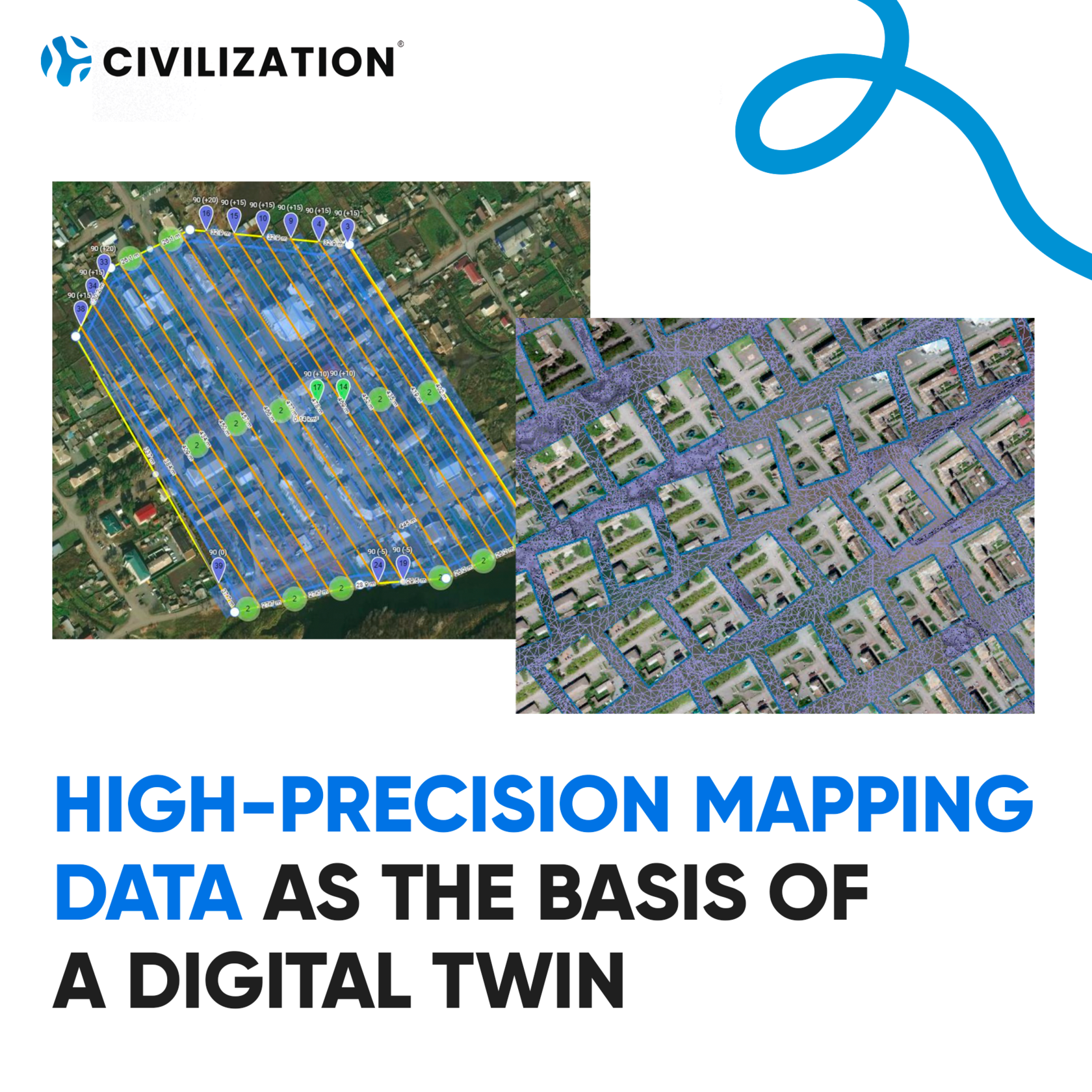
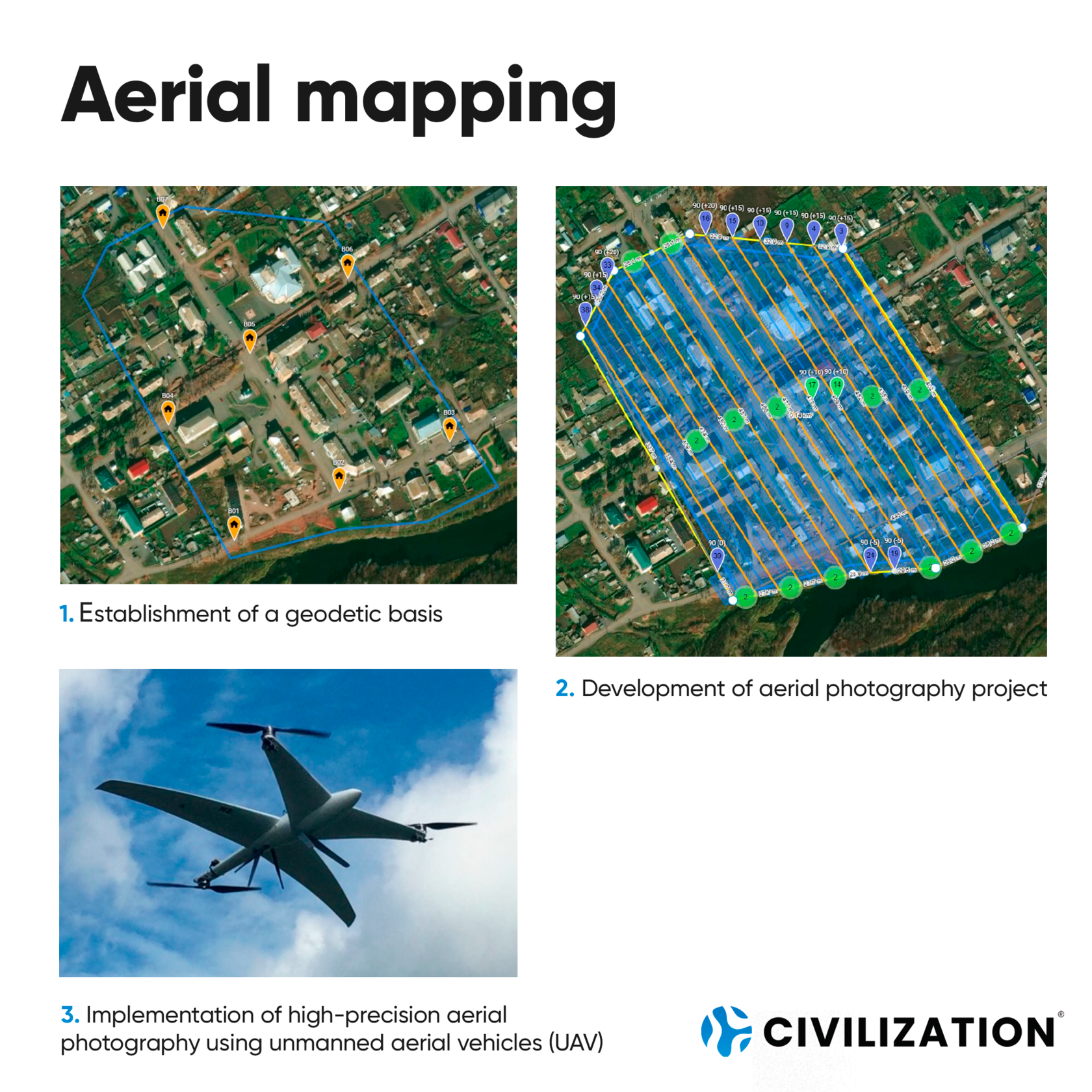
Aerial mapping
1. Establishment of a geodetic basis
2. Development of aerial photography project
3. Implementation of high-precision aerial photography using unmanned aerial vehicles (UAV)
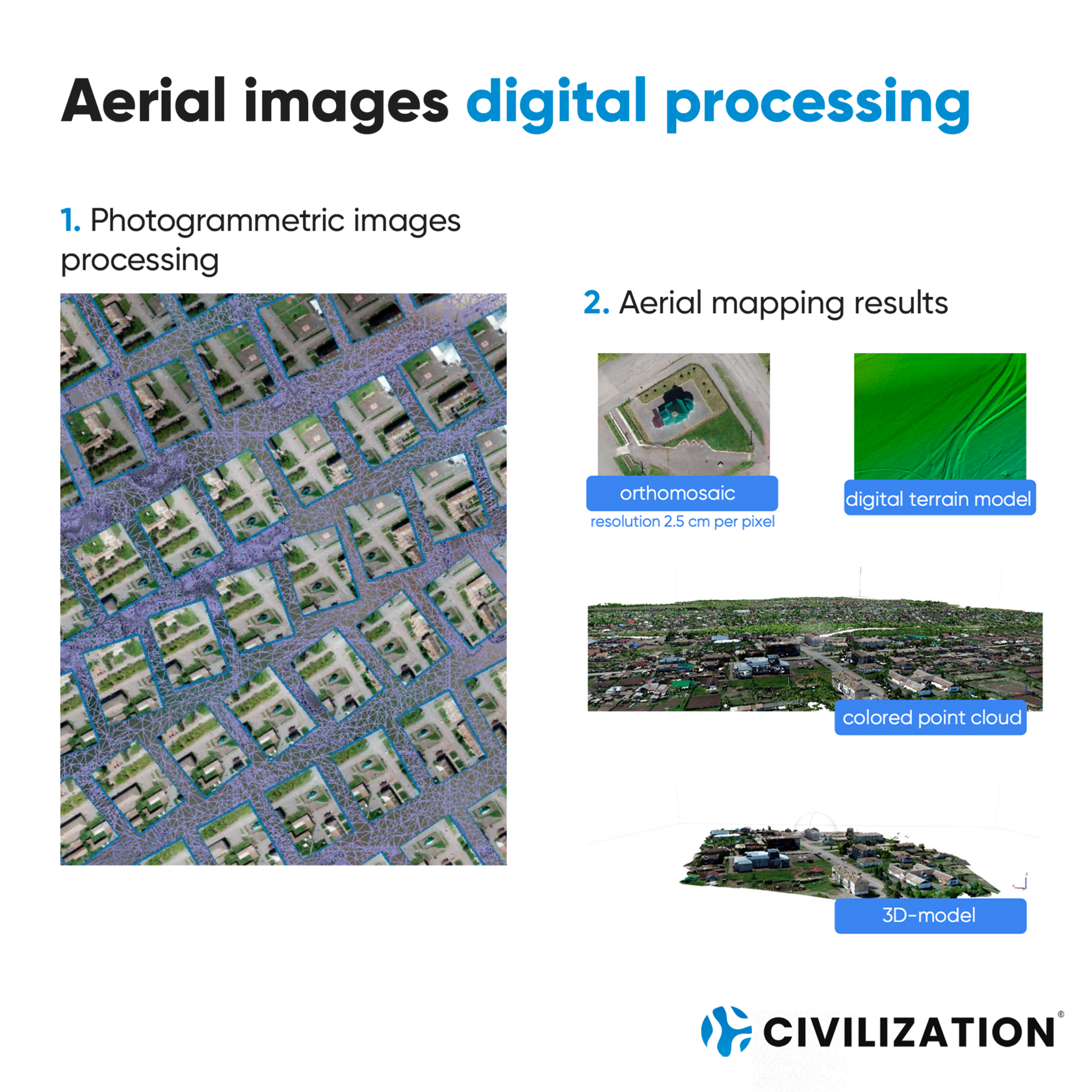
Aerial images digital processing
1. Photogrammetric images processing
2. Aerial mapping results
- orthomosaic (resolution 2.5 cm per pixel)
- colored point cloud
- digital terrain model
- 3D-model
To ensure a high-quality result, aerial photography work must be carried out on the basis of an elaborated project containing the development of a geodetic reference network, the flight program and processing parameters of the obtained material:
Aerial mapping
1. Establishment of a geodetic basis
2. Development of aerial photography project
3. Implementation of high-precision aerial photography using unmanned aerial vehicles (UAV)
Aerial images digital processing
1. Photogrammetric images processing
2. Aerial mapping results
- orthomosaic (resolution 2.5 cm per pixel)
- colored point cloud
- digital terrain model
- 3D-model