Our engineers in a collaboration with the OUT (Oman Think Urban) created an AI-based technology with the purpose of green digital transformation of Oman cities. Our innovative approach makes this project really exceptional – that is why we want to tell you more about it.
Here you can see a short summary of green transformation plan:
1) Searching for areas for greening by means of AI-technologies
• Creation of a digital twin of the city;
• Territory assessment in terms of sufficiency and accessibility of green areas in accordance with planning standards;
• Searching for optimal locations for green areas in terms of cost.
2) Design
• Green areas design by using BIM-technologies
• Community engagement. Public discussions of proposed projects, voting, feedbacks receiving and processing[
3) Implementation and maintenance
• Guidance and supervision of green areas implementation
• Green areas maintenance
Let’s take a closer look on each step of the plan!
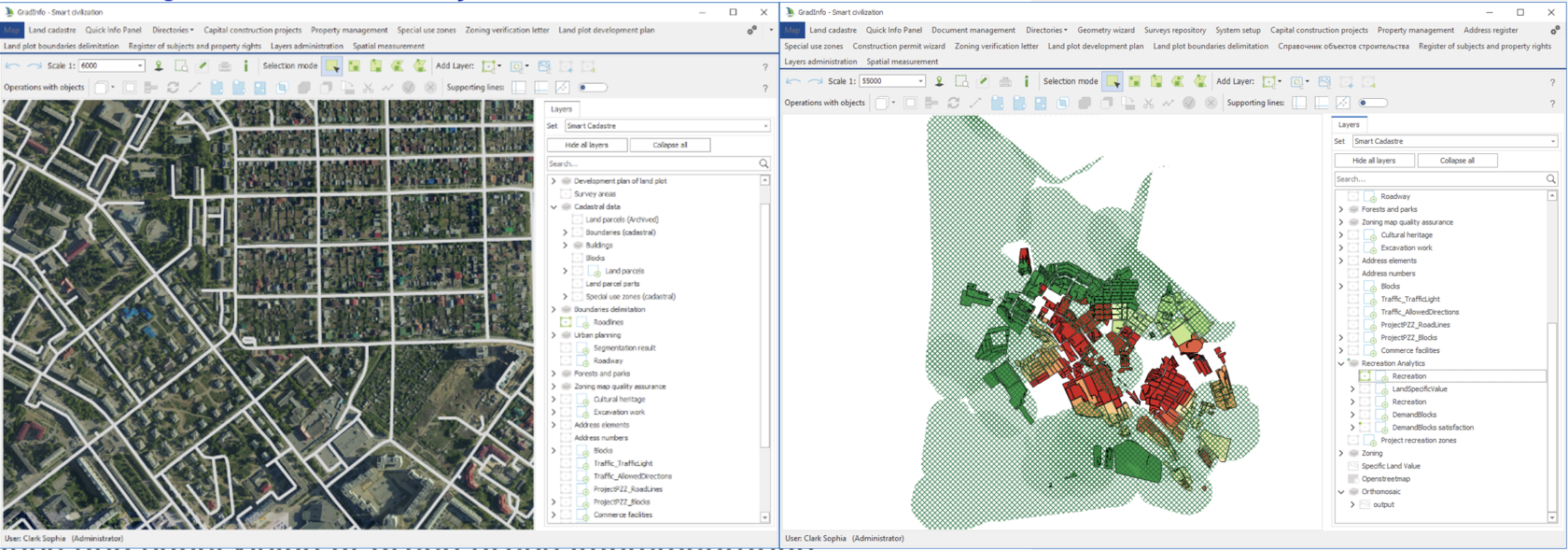
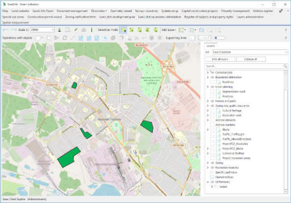
The first step is creating a digital twin of the city and analysis of it.
We provide an integrated analysis that cuts across many areas, here are the list of it:
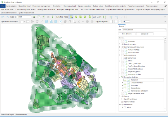
1) Demand blocks and recreation zone
Describing of the current state of the territory in the format of digital model:
• buildings;
• road network;
• Recreation zones;
• Land plots;
• Population distribution.
• buildings;
• road network;
• Recreation zones;
• Land plots;
• Population distribution.
2) Sufficiency and accessibility of green areas
Estimation of the existing green areas capacity in accordance with ONSS parameters
3) Satisfaction
3) Satisfaction
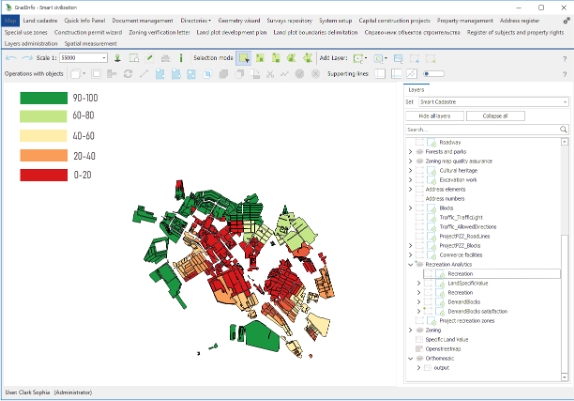
Searching for the territories having deficiency of green areas as per citizens distribution by means of intelligent GIS-analysis
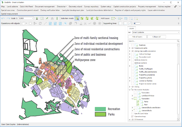
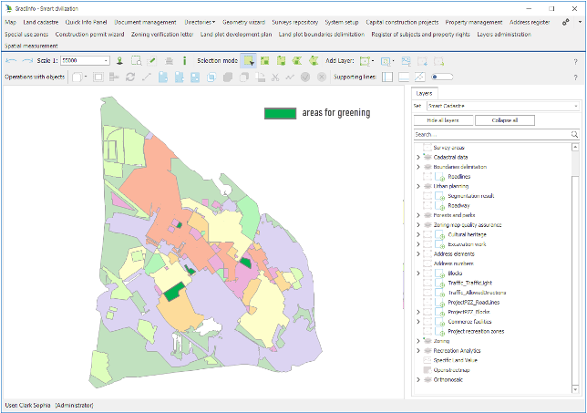
4) Map of land specific value and sufficiency of green areas
4) Map of land specific value and sufficiency of green areas
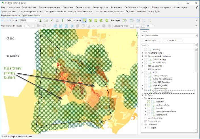
Seeking for optimal location of landscaping in terms of buildings and land plots cost.
Using computational optimization technics, we find optimal greenery locations which meet citizen’s demands and having appropriate cost of construction.
5) Special use zones
Using computational optimization technics, we find optimal greenery locations which meet citizen’s demands and having appropriate cost of construction.
5) Special use zones
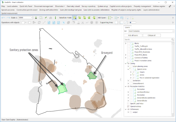
Restricted zones are also taken into account in the analysis. Among them are sanitary protection zones, heritage zones, cemeteries and others.
6) Areas for greening
6) Areas for greening
The result - areas to be greened:
• meeting citizens demands (citizens satisfaction);
• having appropriate construction cost;
• complying with urban planning standards and ONSS goals.
• meeting citizens demands (citizens satisfaction);
• having appropriate construction cost;
• complying with urban planning standards and ONSS goals.
When a comprehensive analysis is done, we can move to the next step – design.
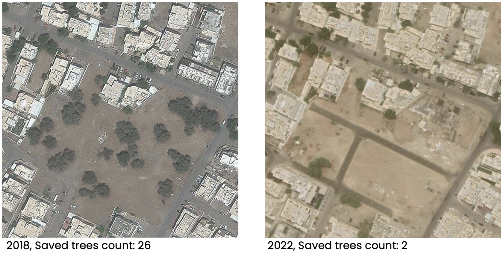
First thing to do on this step is to identificate and protect green zones from construction and land plots forming they should be reserved via special part of urban planning standards (or other way). Also, it’s important to know about Onss policy control and make all documentation clear and suitable for the regulation.
Design principles
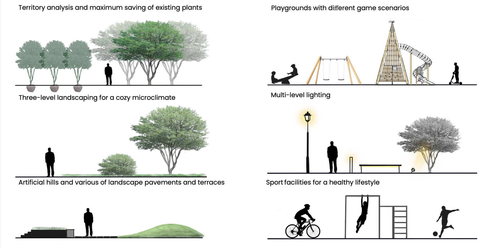
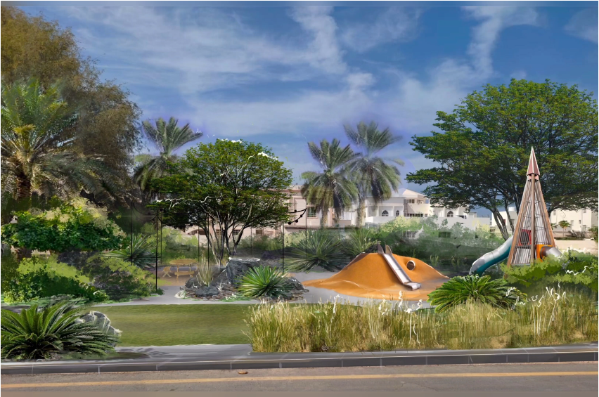
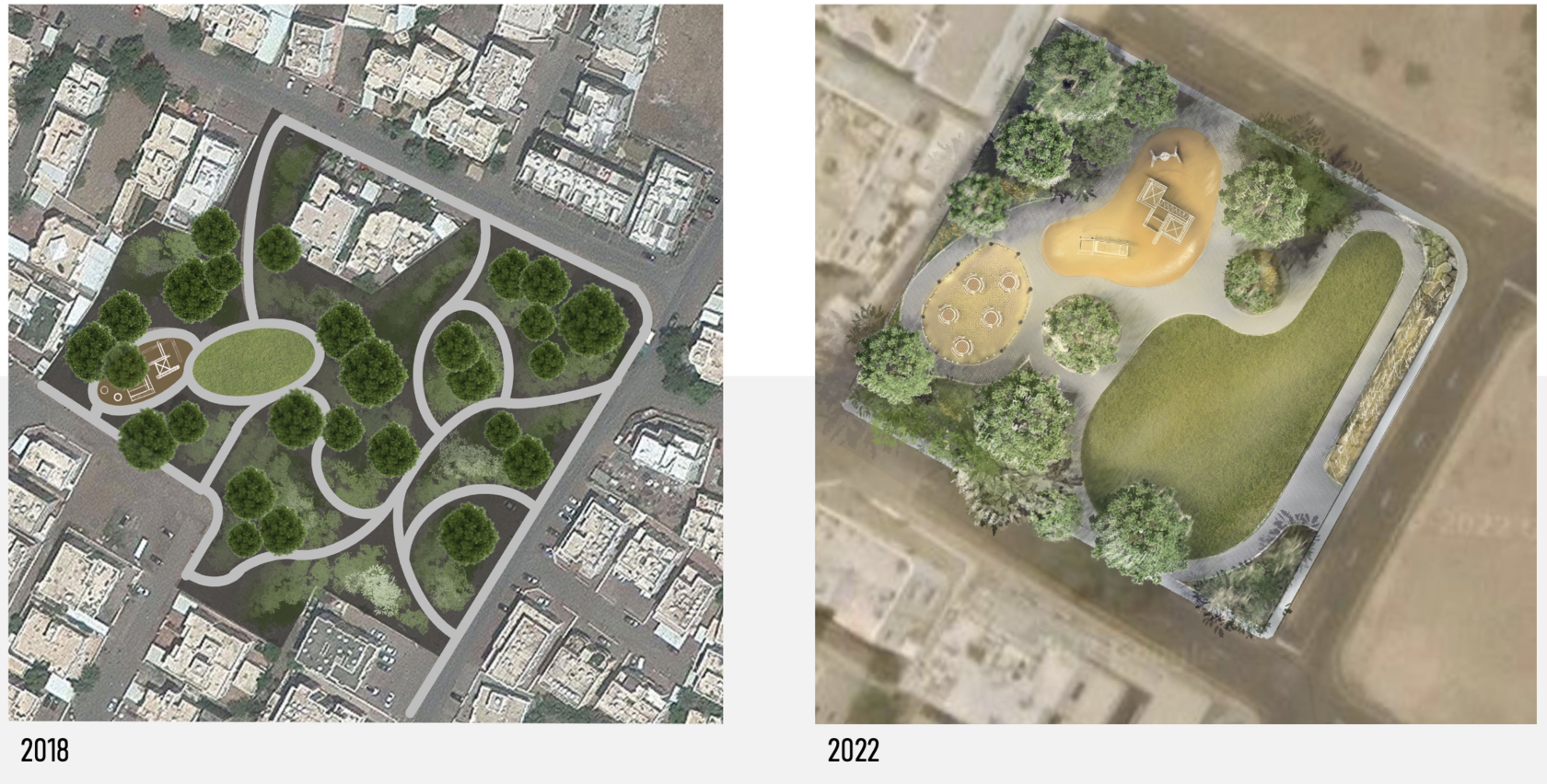
We always provide pre-project analysis of the territory to see how territory has been changing. Moreover, we create design proposals which fits the time.
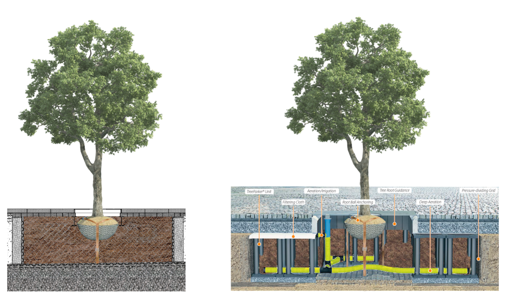
Exploded view
Our modern software allows us to create an exploded view of the system. It helps us to take into account and think through such things like automatic irrigation and fertilizing system, urban tree planting solutions and also root-, soil-, and engineering infrastructure management.
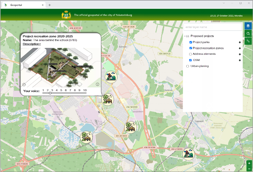
The last but not the least on this step is community engagement. In order to get all the views we create a dedicated web portal which allows people to discuss proposed green spaces and designs with the entire community. We also collect information from community in the ground
And the last step of our green transformation plan is an implementation and maintenance.
On this step we create a thoroughly researched parks maintenance digital solution, which consists of:
• accounting of parks green resources (trees, bushes, grass, flowers);
• parks assets accounting;
• accounting of parks inventory (benches, trash bins, small architectural forms) ;
• planning and control parks maintenance measures (events and budgets);
• accounting of park preservation measures: sanitary felling, garbage collection, fire protecting.